
A sustained period of heavy rainfall has gripped Nairobi and the wider metropolitan region, triggering widespread flooding, road closures, and heightened safety concerns according to a new advisory issued for the period between April 27 and May 2.
The advisory, based on data from the Kenya Meteorological Department, warns that continuous downpours have already saturated the ground in highland areas such as Limuru, Kikuyu and Ngong, significantly increasing the risk of flash floods across the city and its surroundings.
Officials say major rivers feeding into the city, including the Nairobi, Mathare, Ngong and Kamiti rivers are currently running at elevated and potentially dangerous levels, raising the likelihood of overflow into residential and commercial areas.
The meteorological agency forecasts rainfall exceeding 20 millimetres within 24 hours, accompanied by strong winds of over 25 knots. The probability of continued rainfall between Tuesday and Wednesday stands at 90 to 95 percent, marking what authorities describe as the most critical window of the week.
“Because the ground is fully saturated, virtually all new rainfall becomes immediate surface runoff,” the advisory notes, warning that floodwaters from highland regions can reach central Nairobi within three to six hours.
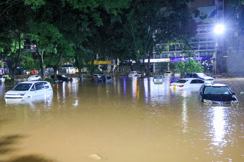
Several key roads across the city have already been affected, with some rendered completely impassable. Among the worst-hit areas are Westlands and Parklands, where sections of Limuru Road and Parklands avenues are reported to be flooded or blocked due to river overflow.
Traffic disruptions have also been reported along major transport corridors, including Waiyaki Way, Kangundi Road, the Nairobi Expressway, and Mombasa Road, where motorists are being advised to expect significant delays or avoid travel altogether.
Authorities have urged residents to avoid driving through flooded roads, citing hidden dangers such as open manholes, deep potholes and submerged debris. Residents living near riverbanks have been advised to move valuables to higher ground and prepare for possible relocation.
The advisory further identifies Eastleigh, the Industrial Area, Gikomba Market, and parts of South B and South C as high-risk zones, with potential flooding expected to worsen during peak rainfall periods.
While conditions are expected to gradually ease towards the end of the week, officials caution that saturated ground will slow drainage, prolonging flood risks even after rainfall subsides.