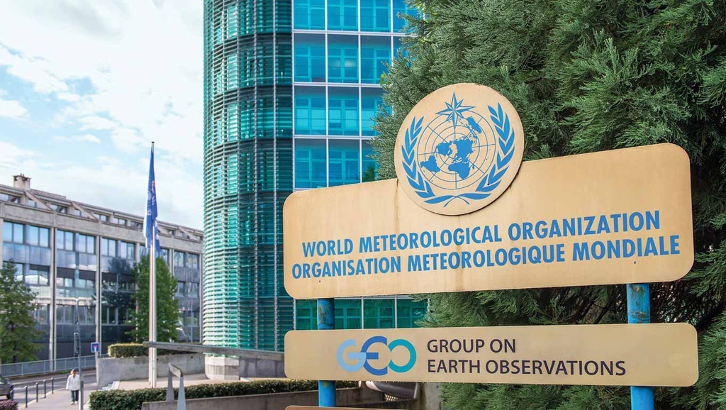

The World Meteorological Organisation (WMO) has warned that an intensifying El Niño is almost certain to persist until at least February 2027.
The UN weather agency said El Niño is firmly established and will intensify into a very strong event in the coming months, bringing major shifts in rainfall and temperature patterns and increasing the risks of floods, drought and extreme heat.
Forecasts from WMO’s Global Producing Centres indicate an “exceptionally high likelihood of nearly 100%” that El Niño will persist through February 2027.
The UN weather agency said exceptionally warm conditions in the tropical Pacific Ocean are driving the intensification of the phenomenon, which is expected to reach very strong intensity before peaking towards the end of 2026.
“Sea surface temperatures are rising, temperatures keep climbing, and the world is in the danger zone of extreme weather. The race now is between rising risks and our commitment to take climate action and protect people. We must win that race,” United Nations Secretary-General António Guterres said.
For Kenya and other countries in East Africa, the development will heighten concerns about possible disruptions to rainfall patterns, agriculture, water resources and livelihoods.
El Niño is among the most powerful naturally occurring influences on the global climate system and can significantly alter rainfall, temperatures and atmospheric circulation thousands of kilometres away from the tropical Pacific.
However, WMO cautioned that a very strong El Niño does not necessarily produce the same impacts everywhere.
Its effects vary depending on location and season and can be influenced by other climate drivers, including conditions in the Indian and Atlantic Oceans.
This is particularly important for East Africa, where conditions in the Indian Ocean play a significant role in shaping seasonal rainfall.
WMO said a positive phase of the Indian Ocean Dipole is expected to develop during the September-November 2026 period, while the equatorial Atlantic basin is also forecast to remain generally warm.
The agency said these conditions could “reinforce, weaken or alter typical El Niño impacts in different regions”.
For Kenya, this means that while the global El Niño forecast provides an important warning, the precise impacts on different parts of the country will depend on how several climate systems interact.
WMO said national meteorological and hydrological services remain the authoritative source of official warnings and locally relevant climate information.
A strong El Niño increases the likelihood of major shifts in rainfall and temperature patterns across many parts of the world.
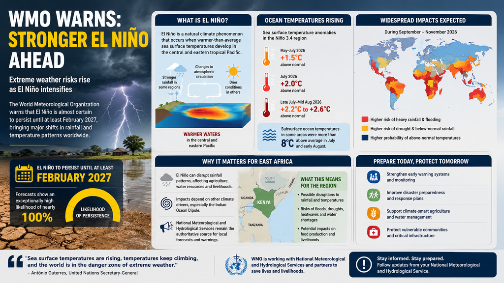
For some regions, this can mean unusually heavy rainfall and flooding, while others could experience suppressed rainfall, drought and worsening heat.
On the continent, such climate disruptions could have serious implications for food production, water availability and livelihoods, particularly in communities that depend on rain-fed agriculture and livestock.
WMO Secretary-General Celeste Saulo said the developing event could deliver severe consequences for communities and economies worldwide.
“We are already seeing disruption and devastation from droughts and floods and we expect these impacts to increase as El Niño intensifies,” Saulo said.
She called for urgent preparedness as countries brace for the possibility of an exceptional event.
“This exceptional El Niño demands exceptional preparation and response,” Saulo said.
“Never before in the 50-year history of the World Meteorological Organization have we launched such a major mobilization with National Meteorological and Hydrological Services who are on the frontline of delivering the forecasts and services to save lives and livelihoods.”
The intensifying El Niño is being fuelled by exceptional warming across the central and eastern equatorial Pacific Ocean.
Sea surface temperatures in the region, one of the key indicators of El Niño, are already well above average and continue to rise.
The widely used Niño 3.4 index, which measures sea surface temperature anomalies in the central-eastern Pacific, averaged 1.5 degrees Celsius above normal between May and July 2026 before rising to 2 degrees Celsius above normal in July.
Weekly values between late July and mid-August climbed further to between approximately 2.2°C and 2.6°C above average.
Even more exceptional warming has been recorded below the ocean’s surface, where temperatures in some areas were more than 8°C above average during July and early August.
WMO said the combination of unusually warm surface and subsurface ocean conditions provides strong support for continued El Niño conditions and further intensification in the coming months.
Confidence in the outlook is high because of strong and mutually reinforcing oceanic and atmospheric signals, as well as close agreement among seasonal prediction systems.
The effects of the developing El Niño will not be limited to rainfall. For September to November 2026, WMO’s multi-model forecasts indicate an increased likelihood of above-normal temperatures across almost all land areas.
The agency said rainfall patterns are also expected to show a pronounced response to the strong Pacific El Niño.
While El Niño is a naturally occurring climate phenomenon and is not caused by climate change, it is unfolding against a backdrop of exceptionally warm global oceans and rising temperatures.
El Niño typically develops between March and June and reaches its peak intensity between November and February. Its effects on global temperatures, however, can continue beyond the period of peak ocean warming and may be most pronounced in the year following its development.
This means that even after the phenomenon reaches its peak, countries could continue experiencing its climate and socio-economic consequences well into 2027.
WMO said the high confidence in the forecast provides governments, humanitarian agencies, businesses and communities with valuable time to prepare.
The organisation and national meteorological agencies are stepping up preparedness and early-warning efforts to help countries anticipate and respond to potential climate-related disasters.
“WMO is committed to working closely with partners across the United Nations and humanitarian system to provide the climate intelligence and insights needed to support disaster management and climate-sensitive sectors like agriculture, health, energy and water resources,” Saulo said.
ENDS